
New Bern Previous Residents by Era
One address leaves several kinds of records behind it. Craven County GIS connects a current parcel to an owner name, deed reference, sale date, property address, E911 address, and map geometry. The Register of Deeds holds recorded land documents. Historical directories identify dated occupants, while maps and permits add evidence about the physical place. Treat each as a separate strand, then compare the descriptions before deciding that the records point to the same parcel.
| Source | Years It Covers | Where Held | What It Shows |
|---|---|---|---|
| Parcel and tax layers | Current county view | Craven County GIS | Parcel, owner, property and E911 address, deed and sale fields |
| Grantor-grantee deeds | Permanent land records; online cutoff not stated | Craven County Register of Deeds | Grantor, grantee, legal description, deed and plat references |
| City directories and street guides | Documented runs from 1893 to 1967 | Kellenberger Room and DigitalNC | Dated names, addresses, and reverse street evidence |
| Federal census schedules | Released schedules through 1950 | Library genealogy access and federal sources | Household-level comparison for the census year |
| Sanborn maps and permits | Maps from 1885 to 1948; current permit services | Library of Congress, NCSU list, city and county services | Building, lot, change, and address context |
Begin with the current parcel when a street number is known. Begin with a directory or census when only a family name is known. The online deed index’s precise coverage is not stated in the research, so an online search ending at an older record is a reason to contact the office, inspect books or microfilm, or request the appropriate county record rather than assume the chain has ended.
Craven County’s map3 service is the source for the parcel, owner, sale, deed, tax, E911, and property-address layers used at the start of this trail.
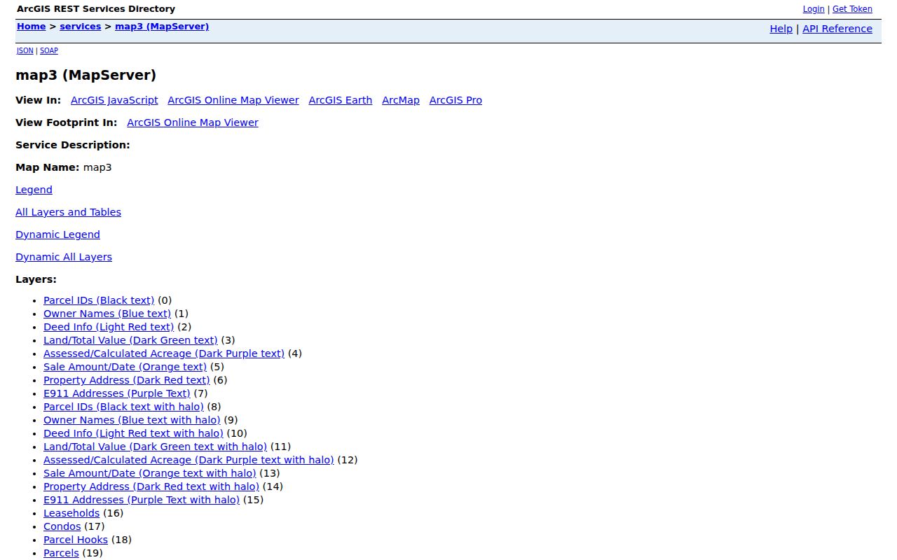
A map result identifies a property record and its context. It does not establish who is currently present at the address.
Start at a New Bern Parcel
The Craven GIS route begins with the property or situs address, the parcel ID, or an owner name. The service can show the current owner, deed information, sale amount and date, acreage, assessed value, property address, E911 address, and tax fields. A situs address is the physical parcel location. An E911 address is the emergency-location point. A mailing or tax address is where the notice goes, and can be somewhere else entirely.
Capture the returned parcel ID, legal description if shown, map location, owner name, sale field, and deed reference. The map is informational and should be checked against deeds and plats. Owner-name searching uses deed-style names, requires a last name in the documented tips, begins with the entered text, and can use a contains pattern such as %MARY%. A shorter search can help when a first name or spelling blocks a match.
Note: A parcel owner or tax-mailing address is not proof that a named person currently lives at the property.
New Bern Previous Residents and Deeds
Ownership is traced backward through the Craven County Register of Deeds, not through the directory alone. Start with the current owner and deed reference from GIS. Find that owner’s acquisition, read the seller and legal description, then search the seller as an earlier grantee. Repeat the loop while checking the lot, block, subdivision, metes-and-bounds description, or plat reference at every link. An old street number can change while the legal parcel remains stable.
- Pull the current parcel record and record its PIN, owner, deed reference, situs address, and legal description.
- Search the current owner’s purchase in the grantor-grantee index, then read the deed image or office copy for the seller and earlier description.
- Search that seller as a grantee to locate the seller’s earlier acquisition, adjusting for initials, married names, estate representatives, trusts, and corporate titles.
- Compare the legal description, plat, and parcel geography at each transfer before adding another person to the address history.
- When online access stops, use the Register of Deeds office, older books or microfilm, or a public-record request for the next link.
- Grantor
- The person or entity transferring an interest in a recorded deed.
- Grantee
- The person or entity receiving that interest. Searching a seller as a former grantee moves the chain backward.
- Chain of title
- The linked sequence of recorded transfers for the same legal parcel.
- Criss-cross directory
- A street or reverse section that takes an address to a listed person or household.
- Enumeration district
- The area assigned to a census taker, useful when pairing a dated address with a census schedule.
Plats provide the bridge from a street address to the legal description. A subdivision name, lot and block, recorded plat book and page, and parcel geometry can explain a changed street form or a shared boundary. Retain the recorded description at each step. The map supplies a helpful location check, but the deed and plat carry the legal details needed to avoid joining two similarly named streets or parcels.
When Craven Deed Access Pauses
The official online Register of Deeds search link returned a 403 during the research inspection, and the public materials did not state an exact online imaging or index cutoff. That is an access limitation, not evidence that older deed records are gone. The state retention schedule identifies permanent land records, plats, and indexes, and its procedures allow older bound records to move under schedule rules.
A February 2026 county agenda included a proposal to digitize historic deed books 1 through 200. It described books 1 through 107 as mechanical Mylar and books 108 through 200 as sewn binders, but it was a proposal rather than verified completion. Ask the Register of Deeds about the needed book, page, microfilm, or office route. The county office is at 226 Pollock Street, New Bern, with published weekday hours of 8 a.m. to 5 p.m. and a 4:30 p.m. recording cutoff.
New Bern Address Guides
Directories supply occupants, while deeds supply owners. The 1911-1912 New Bern directory’s street guide creates a documented address-to-person route. Search the street number in its reverse section, then use the alphabetical portion for the person, listed pursuit, and residence. The 1966 guide places numbered streets in numerical order and named streets alphabetically, with addresses beneath the street and cross streets at crossings.
Search both halves of the volume. One may reveal the name while the other confirms the location. The older collection is described in more detail in the New Bern directory book. Do not force a literal match when an address looks different. A plat, subdivision name, lot and block, metes-and-bounds description, or parcel geometry can bridge an old form of the address to a current map.
The 1911-1912 directory scan is the source for the documented reverse street method.
New Bern Previous Residents in Census
A directory gives a date-stamped listing. A federal census can test the household at the matching census year, when the schedule is released. The research identifies 1950 as the latest currently released federal census in the State Library genealogy guidance. Use the two sources together, but do not treat a directory entry as automatic ownership or assume a name match is enough without an address, age, relatives, or other supporting detail.
- Record the directory year, street number, spelling, initials, and neighboring entries.
- Choose the released 1900, 1910, 1920, 1930, 1940, or 1950 schedule nearest that dated listing.
- Locate the likely household using the name and place, then compare the street, relatives, and timing with the directory evidence.
- Use the enumeration district only as a route through the census area, not as proof that every address match is exact.
- Check the next directory and local newspaper or estate material to account for a move, death, or changed name.
Newspapers on Kellenberger microfilm and the Historic NC Digital Newspaper Collection can add notices, obituaries, social columns, business changes, and other dated references. The documented New Bern newspaper run reaches from 1751 to the present with missing years, so an absent result can reflect a gap in the surviving local coverage.
New Bern Sanborn and Permit Clues
Maps help test whether the structure and street setting make sense for the directory or deed period. The Library of Congress has an 1885 New Bern Sanborn map, and the official NCSU list identifies ten New Bern maps from 1885 through 1948. Local preservation material identifies updates in 1898, 1904, 1908, 1913, 1924, 1931, and 1948. These maps can show footprints, lot context, and building use, but they do not identify a present household.
Permit and inspection information builds a later physical timeline. The city map service covers permits in New Bern and its ETJ, and the county announced an online Planning and Inspections Portal in August 2026. A documented permit may supply a project address, project type, dates, cost, inspection status, or construction detail. Exact public fields for the city service were not rendered during research, and a public code-enforcement search was not verified.
The Library of Congress 1885 Sanborn map is the local map source for checking early building and street context.
Dryborough Address History
New Bern address history can cross changing municipal geography. Dryborough was platted in 1806 and annexed to New Bern in 1859. Historical Society material describes the neighborhood as racially diverse and working-class, with free Black artisans, properties, and dense blocks. A present parcel inside the city may therefore have older directory, map, or newspaper references that use a different neighborhood frame.
The city annexation service identifies annexed areas with an annexation name, date, minute-book and page, and acreage. New Bern’s ETJ layer can also separate city, extraterritorial, and county-only parcels. Pair those layers with the parcel ID and the deed’s legal description before assuming an older New Bern label has the same municipal meaning it has today.
Note: No authoritative New Bern street-renumbering or street-renaming table with years was found in the reviewed sources.
New Bern Past Resident Endpoints
When a name disappears from the address trail, look for a dated endpoint rather than guessing. Kellenberger newspapers, obituary and family files, cemetery material, and probate or estate records can supply a death notice, relative, heir, later address, or estate connection. The NC Archives DOC catalog adds Craven miscellaneous records from 1757 to 1929, colonial court material, deeds, plats, estate papers, permanent voter registration, and other finding aids that can lead to a box or folder.
A move is also possible. Compare the next directory, a census schedule, and the old deed’s grantor or grantee names before making a family link. Keep the edition, page, parcel ID, legal-description detail, source URL, and date of access with every finding. That record trail makes it possible to revisit a difficult match without relying on a remembered search result.
Lawful personal use. Use New Bern address history for family, estate, and local-history research. Do not use a name or address to track, harass, or harm a living person; North Carolina protects some address information.