
Walk New Bern Streets by Address
Begin with a physical address, not an assumed household list. Craven County GIS can tie a New Bern address to a parcel, its property or situs address, an E911 location, and the owner data carried in the map service. The property result is a starting point. It does not prove that the owner lives there. A deed can confirm a land transfer, and the official voter lookup can check a named registered voter, but neither creates a complete list of everyone at an address.
For a current street segment, keep a dated note of each parcel ID, address form, and owner spelling. Then use a second official record for any conclusion. The full sequence gives a street directory search a practical trail from land location to ownership, historical address use, and public jurisdiction information without treating one result as final proof.
- Search the known property or E911 address in the Craven GIS map viewer, then save the parcel ID, situs address, owner spelling, and date checked.
- Use Select Parcel or Identify to inspect adjoining parcels and address points along the same street segment. Enable browser pop-ups if the map control does not respond.
- Take the current owner name or deed reference to the Craven County Register of Deeds and seek the recorded instrument or office copy.
- When a name needs confirmation, use the North Carolina voter lookup by name and, where useful, the Craven county filter. It is not a street-wide export.
- For an earlier household, search the 1911-1912 or 1966 street guides through DigitalNC or the Kellenberger Room, preserving the edition and page.
Note: Compare the parcel, person name, and record date before connecting a street result to a current household.
Read New Bern Street Address Keys
One New Bern address can appear in several forms because each record system stores a different key. GIS can show both a property address and an E911 address. The tax mailing address may be somewhere else because it is where notices go. A deed instead relies on a legal description and often a parcel ID. The city and county layers should be read together when an older directory, a current street number, and a parcel boundary do not line up at first glance.
- Parcel
- A mapped unit of land identified by the county, often with a PIN or parcel ID.
- Situs address
- The physical location of the parcel, rather than the place where tax mail is sent.
- Plat
- A recorded map of lots, streets, or boundaries that helps connect an address to its legal description.
- Criss-cross directory
- A historical street guide that reverses a normal name search by listing addresses under streets.
USPS standardizes a mailing address, but a postal label does not establish a city limit or parcel boundary. New Bern’s annexation and ETJ layers are useful when a historical listing used a county or rural description that no longer matches the current municipal setting.
Search New Bern Streets with GIS
The Craven County GIS pairs owner-name tips with map, parcel, and address tools. The documented owner search expects the name as it appears on a deed, with a last name required and a first name optional. For street work, an address or map selection is usually the better first key. The viewer and map services can expose owner, deed, sale, tax, E911, and mapped-layer information, although fields can vary by service.
| GIS control | Use for a street search | Format or caution |
|---|---|---|
| Last name | Find deed-style owner entries | Required in the owner-name tips; begins-with matching. |
| First name | Narrow a person search | Optional; omit it or shorten the name when no result appears. |
| Contains pattern | Find a name fragment | The documented example uses %MARY%; viewer behavior can vary. |
| Property or E911 address | Locate mapped land on a street | It identifies a location, not necessarily an owner mailing address. |
| Parcel ID or PIN | Join a map shape to tax and deed clues | Use the exact county-returned identifier rather than guessing a format. |
| Select Parcel / Identify | Read a target and adjacent parcels | The GIS warns of browser and pop-up issues; enable pop-ups if needed. |
The Craven GIS map viewer is shown below. Its parcel and property tools are a useful first screen for a street search.
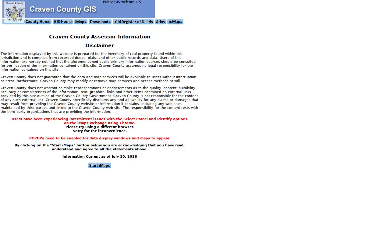
Use the returned parcel data as an informational map record, then confirm an ownership change with a recorded deed or the tax office.
Match New Bern Street Owner Names
Owner names on the parcel map follow the deed style. That matters on a New Bern street where a parcel may be held by a city, county, church, cemetery, lodge, trust, or another organization instead of an individual. Craven’s documented examples include forms such as New Bern-City of, Craven County & New Bern, River Bend- or Riverbend-, Lodge-, and North Carolina-State. The tips also identify church and cemetery formats.
A short, recorded-style surname often works better than a full assumed name. A result must still be read in context. A mailing address may describe the tax recipient, while the situs address identifies the land. A homestead exemption, if present, is only evidence consistent with owner occupancy. It is not proof that someone is currently at home.
The official GIS owner-name search tips show the matching conventions used for these queries.
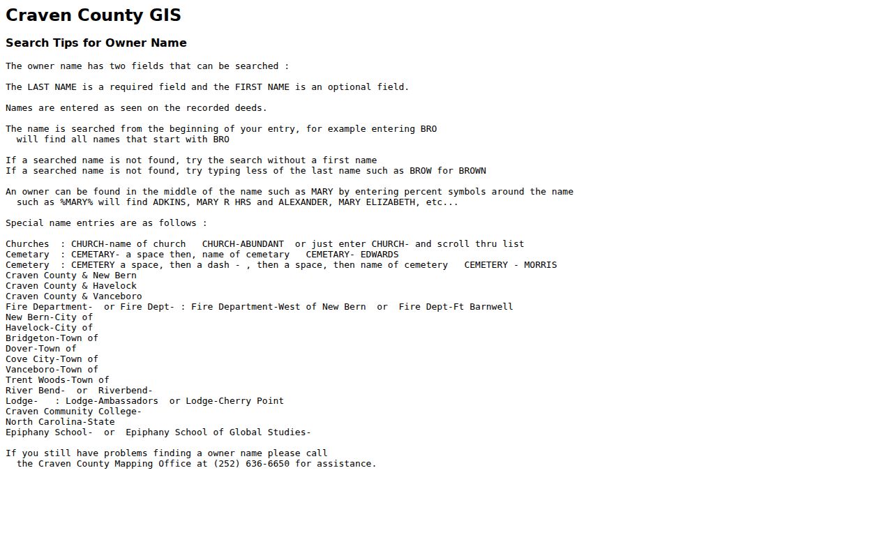
Record the spelling returned by GIS before moving to deeds, because initials, trusts, married names, and organization names can change a later search.
New Bern Street Directory Records
Address-keyed records answer different questions. The parcel and tax layers are strongest for current land ownership and map geography. Deeds explain the recorded transfer and legal description. Historical guides place an occupant at an address in a particular year. A voter result can supply public registration and jurisdiction information for a named person, subject to protections. Permits provide a building timeline, not a current resident list.
| Address record | New Bern keeper | Useful street detail | Access route |
|---|---|---|---|
| Parcel and tax roll | Craven GIS and Tax | Owner, mailing and situs or E911 address, value, acreage, sale, exemptions, and tax status | Free GIS map; county tax route for tax questions |
| Parcel geometry | Craven GIS and New Bern GIS services | Adjacent lots, roads, buildings, flood, zoning, wards, ETJ, and historic districts | Map viewer or REST query |
| Deed or plat | Craven County Register of Deeds | Grantor, grantee, legal lot, book or page, and recorded plat references | Official index link, office, or written request |
| Street guide | Kellenberger Room and DigitalNC | Historical address-to-occupant entries and house-number sequence | Digital scans or research-room help |
| Voter registration | NCSBE and Craven Board of Elections | Named voter status, public address, and jurisdictions when available | Free name lookup; no verified street-wide export |
| Permit or inspection | New Bern and Craven Planning/Inspections | Job site, project type, contractor, cost, and inspection context | Map or portal; exact fields remain unverified |
| Sanborn map | Library of Congress, NCSU, and local collections | Building footprint, street, lot, and use across map years | Digital maps and local research |
Use the parcel ID to connect the map to a deed reference. Use the street name and address number to connect current data to the historical guides. These are separate evidence streams, so a buyer, owner, historical occupant, and public voter record should never be collapsed into one unnamed household.
Trace a New Bern Street Deed Chain
The recorded chain begins with the current parcel owner and deed reference from GIS. In a deed, the grantor is the party transferring land and the grantee is the party receiving it. Save the recording date, instrument number or book and page, legal description, and any plat reference. Then search the seller as an earlier grantee. Check the same lot, block, subdivision, or metes-and-bounds description at each step, because a modern address can change while the legal parcel remains the same.
The official Craven deed-index link was blocked during research, and an online start year or image availability was not verified. The fallback is the Register of Deeds office at 226 Pollock Street, a phone call to 252-636-6617, or a written request that identifies the existing record, date range, person or parcel key, and desired copy type. The State Archives and Kellenberger provide historical routes when local office research reaches older materials.
The official deed-index destination is pictured below. Treat it as a path to an existing instrument, not a complete answer about present occupancy.
When an index or image is unavailable online, the Register of Deeds remains the custodian for recorded land records and can clarify available office access.
Use New Bern Street Guides
The street-guide layer adds a dated household view that property records cannot supply. The 1911-1912 Hill directory has a criss-cross guide that can turn a street address, including a Queen Street number, into a period occupant. The 1966 Hill directory places numbered streets in numerical order and named streets alphabetically, with house numbers beneath each street. Its alphabetical and household sections can add adult name, marital notation, occupation, address, phone, or ZIP details when those details were printed.
Search both the alphabetic entry and street section, then preserve the edition, page, and page side. An address may have been a business, hotel, boarding setting, or residence, and a directory occupant is not automatically the land owner. The documented DigitalNC runs include 1904-1905, 1911-1912, 1937, 1941, 1954, 1958, 1964, 1966, and 1967 materials. The historical volumes and their search methods are collected in the New Bern Directory Book.
Note: Pair a historical street entry with a deed, map, or newspaper before treating it as a continuous household history.
Map New Bern Street Geography
New Bern’s street geography is layered. City GIS services can place an address among city limits, ETJ, wards, flood zones, historic districts, roads, streams, building footprints, and county parcels. The annexation service records an annexation name, date, minute-book or page, and acreage. That context can explain why a directory used a county description even though a current parcel is inside New Bern, or why a postal label does not match the municipal boundary.
The historic-district layers identify Downtown, Riverside, Ghent, and DeGraffenried, with building outlines, footprints, and property lines. Dryborough adds a local geography test: it was platted in 1806 and annexed in 1859, so older references may not use the same district language seen today. For a changing address, compare the New Bern annexation layer, current parcel geometry, and the historical street guide rather than assuming a street number alone crosses every era.
Check New Bern Address Permits
Permit and inspection records can add a physical history to a New Bern address. The city’s building-permit map service covers New Bern and its ETJ. County planning review considers flood zones, addresses, easements, setbacks, site conditions, septic or sewer questions, plans, and inspections. A legacy form documents fields such as job-site address, project type, square footage, contractor and license, construction type, cost, and inspection information. Those items describe work on a property, not everyone who occupies it.
Craven announced a Planning and Inspections Portal in August 2026 with account creation, applications, scheduling, payment, uploads, and emailed notices. Staff remain available at 2828 Neuse Boulevard on weekdays from 8 a.m. to 5 p.m. The research did not verify the current public search fields or a public code-enforcement case index. Use the county permitting process to identify the proper route, then ask for an existing address-keyed record and date range.
Protect Privacy in New Bern Street Searches
A street directory can identify parcels and some public records, but it cannot establish every person in a home. Renters, household members who are not owners, protected voters, utility customers, delivery recipients, and unlisted phone users are outside the verified public street method. A voter no-match can reflect spelling, status filters, a recent update, or a protected record. North Carolina’s Address Confidentiality Program restricts actual addresses and phone information for qualified participants, and a public search must not be used to reconstruct a protected location.
Lawful use. Use New Bern address records for lawful personal research, family history, estate questions, or civic context. Do not use public details to stalk, harass, intimidate, or harm anyone.
Craven’s Register of Deeds legal notice also provides a no-fee written path to request redaction of listed sensitive data from a recorded document. Requests may be mailed, faxed, sent electronically, or delivered in person, but they must identify the document and location. The public copy is a convenience; the office record remains the authoritative one.