
New Bern ZIP Code Coverage
Official materials identify five ZIP codes with New Bern postal labeling: 28560 through 28564. The state tax table explicitly places 28561, 28563, and 28564 in New Bern and Craven County, and lists 28562 in both Craven and Jones counties. The reviewed sources do not publish neighborhood polygons or station-by-station boundaries. For that reason, the table identifies the documented postal or county connection instead of assigning a neighborhood that has not been verified.
| ZIP | Areas Covered | Post Office | Notes |
|---|---|---|---|
| 28560 | New Bern-labeled postal service area | Use USPS address lookup for an exact address | Neighborhood boundary was not published in the reviewed sources. |
| 28561 | New Bern, Craven County in the NCDOR table | Specific station not documented | Address-level USPS verification remains necessary. |
| 28562 | New Bern listing in both Craven and Jones county entries | Specific station not documented | A postal label does not prove county or city limits. |
| 28563 | New Bern, Craven County in the NCDOR table | Specific station not documented | Included in the 2019 routing-label context. |
| 28564 | New Bern, Craven County in the NCDOR table | Specific station not documented | Included in the 2019 routing-label context. |
The ZIP code directory therefore begins with a coverage clue, not a list of people. USPS can standardize an address and return its mailing ZIP. Craven GIS can place a parcel in county and municipal context. The election tool can confirm a precinct for a complete residential address. Each is an address check with a separate purpose, and none should be used to infer a household from a ZIP alone.
Verify New Bern ZIP Codes With USPS
The USPS ZIP Code Lookup is the address-level authority. Its By Address form uses a required street address, city, and state, with company and unit fields optional and ZIP optional. The By City and State option requires the city and state, while Cities by ZIP requires a ZIP. USPS cautions that a result does not confirm a person or company at an address. When more than one result appears, add the street and unit and use the standardized form of the address.
The official USPS lookup is shown below for the New Bern ZIP code directory workflow.
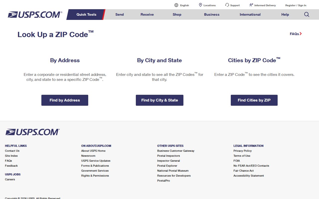
Use the returned ZIP as a postal reference, then compare it with the parcel’s situs or E911 address before making a county or city conclusion. USPS confirms mail delivery formatting, not ownership, occupancy, precinct, or legal parcel description. Those questions require the relevant county or state custodian.
Note: USPS results standardize delivery addresses, while parcel and election systems answer separate geography and jurisdiction questions.
Find New Bern Residents by ZIP Code
A ZIP can narrow an address investigation, but the documented local portals do not support a verified public bulk resident list by ZIP. Craven GIS has owner-name, parcel, property or situs address, map identify, and layer controls. The state voter registration lookup is name-based. The polling-place tool accepts a full residential address and includes a ZIP field. Use a ZIP to validate and organize an address first, then search the particular record system by the fields it actually displays.
- Check the street, unit, city, and state in USPS to confirm the mailing ZIP and standardized address.
- Open Craven County GIS and search the parcel or address, keeping the situs, E911, parcel ID, and mailing fields distinct.
- Use the polling-place lookup with the complete residential address to confirm precinct and jurisdiction context rather than treating a ZIP as a city boundary.
- When a known name is relevant, use the voter search or another official index and compare the result with the parcel or address record.
Once a ZIP has narrowed the area to a particular road, the New Bern Street Directory provides the address-keyed trail through parcels, deeds, maps, and historic street guides. The full voter-file request form, cost, delivery format, and permitted-use terms were not documented in the official sources reviewed, so they should be requested from NCSBE or the Craven Board of Elections rather than assumed from the lookup screen.
New Bern Polling ZIP Fields
The North Carolina polling-place lookup has Search by Precinct and Search by Address tabs. In the rendered Address instructions, County, Precinct, Residential Address, City, State, and ZIP are required fields. The tool recommends trying directional variants and including the street type. It is a useful jurisdiction check when a New Bern postal label crosses another local boundary, but it is not a ZIP-wide resident-search tool.
| Visible address field | Type | Required status | How it helps |
|---|---|---|---|
| County | Select | Required | Sets the county context for a polling search. |
| Precinct | Select | Required | Pairs the address with a precinct selection. |
| Residential Address | Text | Required | Use the physical street address, not a mailing box. |
| City | Text | Required | Enter the postal city returned or accepted by the address. |
| State | Select | Required | Choose North Carolina. |
| ZIP | Text | Required | Visible ZIP field for the complete address lookup. |
A source-linked view of the polling-place lookup shows the ZIP field in its address workflow.
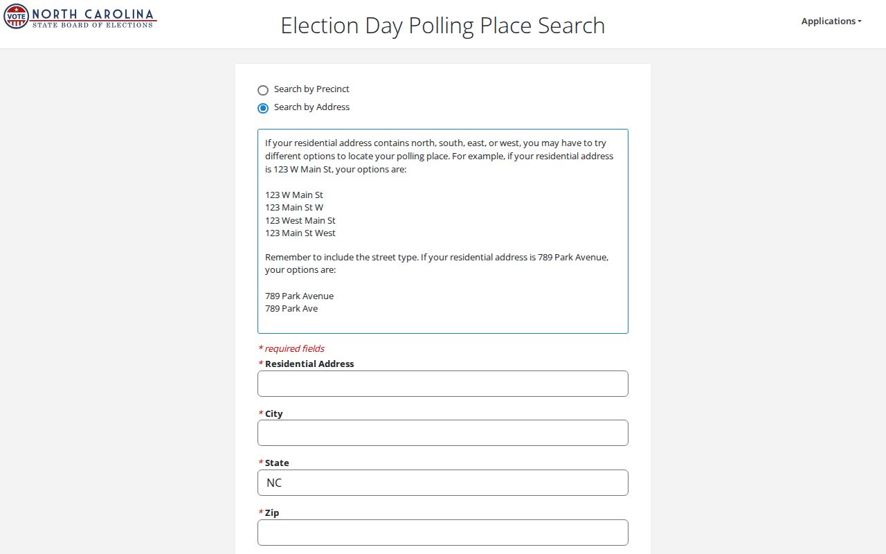
Use the result to verify precinct and jurisdiction. The separate voter-registration search can show public registration context for a named voter, but it does not expose a verified street-wide or ZIP-wide resident export in the sources reviewed.
New Bern ZIP Code Geography
ZIP 28562 makes the local mismatch clear. The NCDOR five-digit table lists it in New Bern entries for both Craven and Jones counties. A postal city label can therefore extend beyond a county line, just as a city limit can differ from a delivery area. Craven map layers and City of New Bern services provide parcels, roads, E911 points, city limits, ETJ, wards, flood areas, and historic districts. Those layers are better tools for geography than a mail label.
New Bern’s historical geography adds another reason to check the parcel. An older directory or newspaper may use a county or rural description for a place that later entered the city through annexation. The New Bern annexations service provides annexation name, date, minute-book and page, and acreage fields. Combine that information with a current parcel and an address check instead of assuming that a ZIP reflects the same boundary in every era.
Note: A ZIP code is a postal routing label, while a city limit is a governmental boundary recorded in local mapping and annexation records.
New Bern Postal Routing Change
The 2019 USPS Postal Bulletin records a New Bern-specific container-label realignment. Destination ZIPs 28561, 28563, and 28564 changed a label-container reference from New Bern 28560 to New Bern 28562. That is a mail-processing change, not a declaration that those destinations are in one neighborhood, one city district, or one county. It is a practical reminder to verify the full address rather than rely on a familiar routing label.
This routing detail is especially useful when historic mail, a directory entry, or an older document conflicts with a current address label. Keep the document date and the USPS result together. For a legal address or recorded property description, defer to the deed, plat, and county parcel record.
New Bern ZIP Address Keys
Postal work becomes clearer when four address keys are kept separate. The GIS service can expose property and E911 addresses, while the Register of Deeds uses legal descriptions and parcel identifiers. A tax mailing address tells where a notice goes. A USPS result standardizes a delivery address. The records may match, but their functions are different. A city-limit question should be checked in GIS, and a recorded-lot question should be checked with the Register of Deeds.
- ZIP versus ZIP+4
- A five-digit ZIP identifies a broad postal area. ZIP+4 adds a smaller delivery segment for a more precise mailing address.
- PO-box ZIP
- A ZIP used for post-office boxes. The reviewed sources did not verify a New Bern PO-box-only designation.
- Unique ZIP
- A ZIP assigned to a single organization or destination. No New Bern unique-ZIP list was found in the reviewed official sources.
- Carrier route
- A postal delivery sequence within a ZIP area. It is not a municipal boundary or a public resident list.
- Situs and E911 address
- Situs identifies the parcel location; E911 identifies an emergency-location point. Both can differ from a tax mailing address.
New Bern ZIP Code History Clues
A modern ZIP does not solve an older address by itself. The 1966 Hill directory includes alphabetical and household or street-guide sections, with methods that could show names, marital notation, occupation, street number, phone, and ZIP numbers. It also reaches nearby communities and rural routes. Use its street sequence to locate an earlier household or building, then compare the result with a current GIS parcel and USPS address check. The directory is historical evidence, not proof of a present occupant.
Sanborn maps add a physical check for a historic address. Official map lists identify New Bern sheets from 1885 through 1948. A map, a directory street guide, a parcel geometry, and a deed can show whether an address changed form or whether a building footprint is consistent across years. This family-history route is more reliable than forcing a current postal boundary onto an old street description.
Note: Preserve the directory edition, map year, and current parcel identifier so later address comparisons remain tied to their dates.
New Bern ZIP Code Boundary Limits
The New Bern ZIP code directory can verify a postal label and help organize an address search. It cannot prove that an address lies inside New Bern city limits, inside Craven County, in a particular neighborhood, or at a particular residence. The official sweep did not find neighborhood-level ZIP polygons, a definitive city-line and ZIP crosswalk, named post-office station coverage, or a verified list of PO-box-only and unique ZIPs. That absence is a research gap, not a reason to fill in a boundary from a map pin or a mailing label.
Boundary check. For a contested New Bern address, compare USPS delivery information with Craven GIS and the New Bern city-limit or annexation layers before relying on the location.